Ga naar hoofdinhoud

Technology & Innovation Satellites

Technology & Innovation Satellites

Harmony satellites

observe climate processes
Text Jos Wassink
© Stephan Timmers

Space missions have a long lead time. According to the schedule, the pair of Harmony observation satellites selected by the European Space Agency (ESA) last year as the tenth Earth Explorer will not be launched from Kourou in French Guiana until 2029. 

The 420-million-euro project is the brainchild of geoscientist Paco López-Dekker and his team at the Geoscience and Remote Sensing department (Faculty of Civil Engineering and Geosciences, CEG). Their proposal comprises two satellites which work together, in close harmony, of course, with ESA’s satellite Sentinel-1D – a radar satellite which orbits the Earth in a polar orbit.  

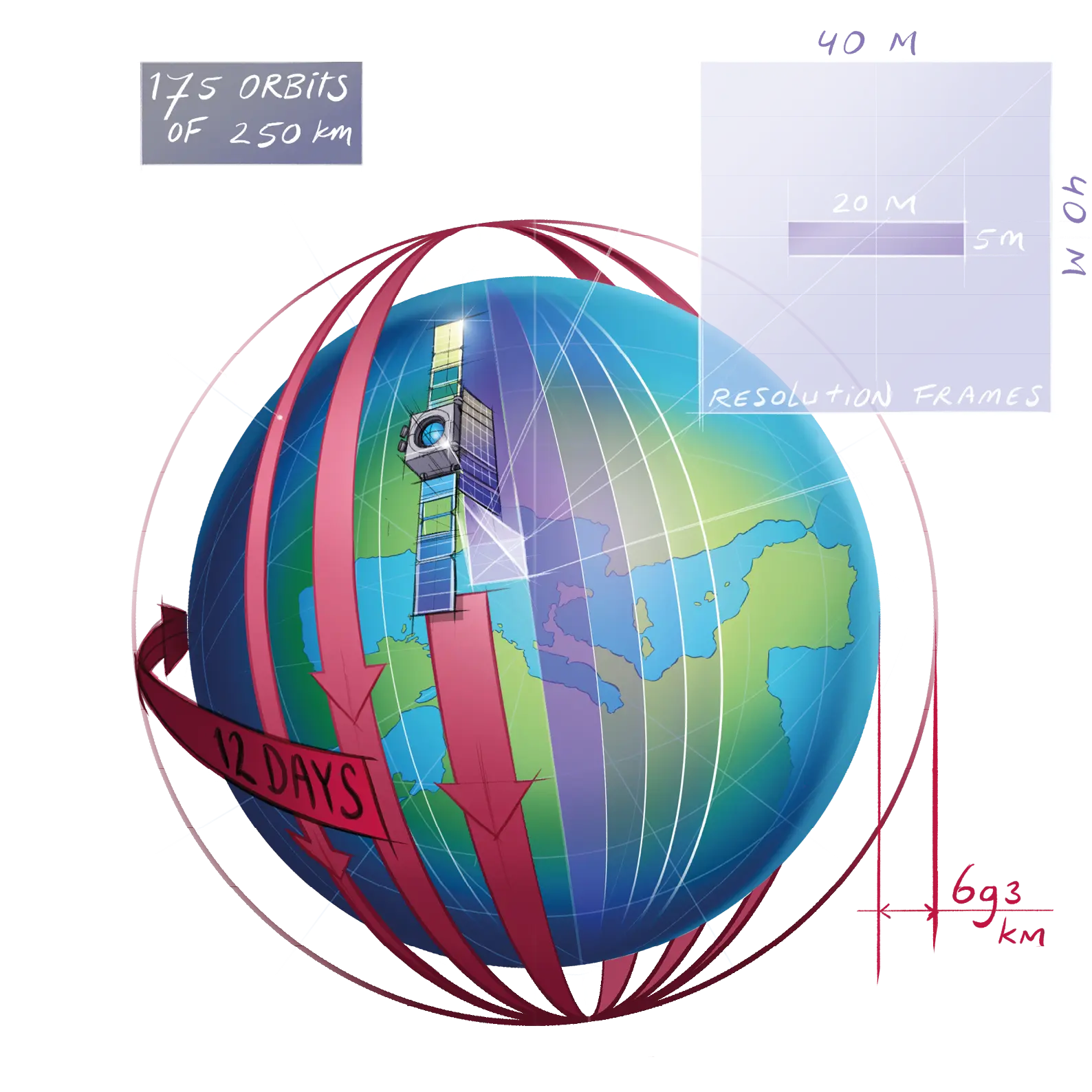
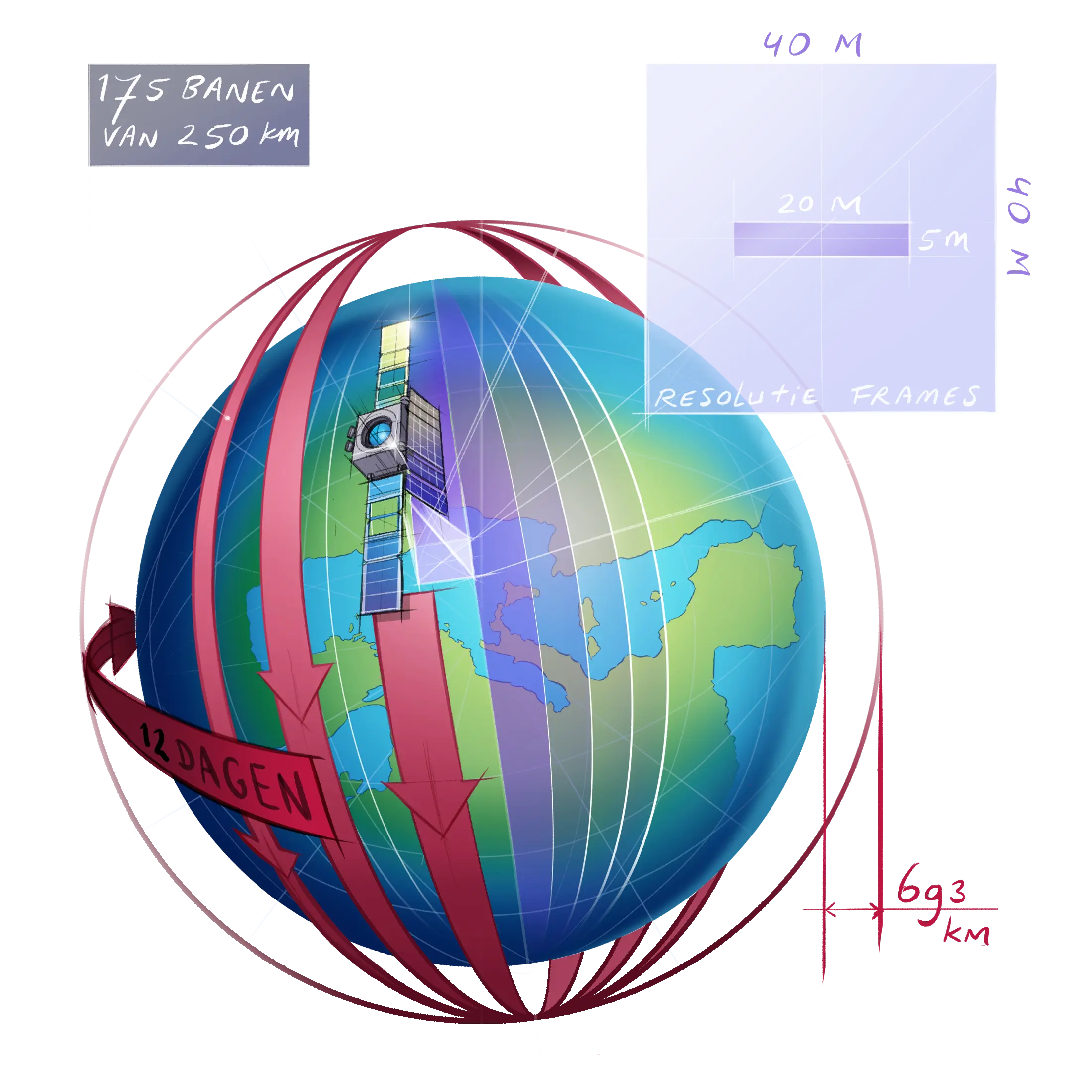
 The Earth actually continues turning under Sentinel while the satellite always covers the same orbit, 693 kilometres above the North and South Poles. After 12 days, the satellite will have flown around the Earth 175 times (with an orbit time of approximately 90 minutes) and returned to its starting point. So every point on Earth can be scanned every 12 days, and points closer to the poles more frequently than that. The radar bundle scanning the Earth is 250 kilometres wide as standard (and narrower for a higher resolution).

Text Jos Wassink
© Stephan Timmers

Space missions have a long lead time. According to the schedule, the pair of Harmony observation satellites selected by the European Space Agency (ESA) last year as the tenth Earth Explorer will not be launched from Kourou in French Guiana until 2029. 

The 420-million-euro project is the brainchild of geoscientist Paco López-Dekker and his team at the Geoscience and Remote Sensing department (Faculty of Civil Engineering and Geosciences, CEG). Their proposal comprises two satellites which work together, in close harmony, of course, with ESA’s satellite Sentinel-1D – a radar satellite which orbits the Earth in a polar orbit.  

 The Earth actually continues turning under Sentinel while the satellite always covers the same orbit, 693 kilometres above the North and South Poles. After 12 days, the satellite will have flown around the Earth 175 times (with an orbit time of approximately 90 minutes) and returned to its starting point. So every point on Earth can be scanned every 12 days, and points closer to the poles more frequently than that. The radar bundle scanning the Earth is 250 kilometres wide as standard (and narrower for a higher resolution).

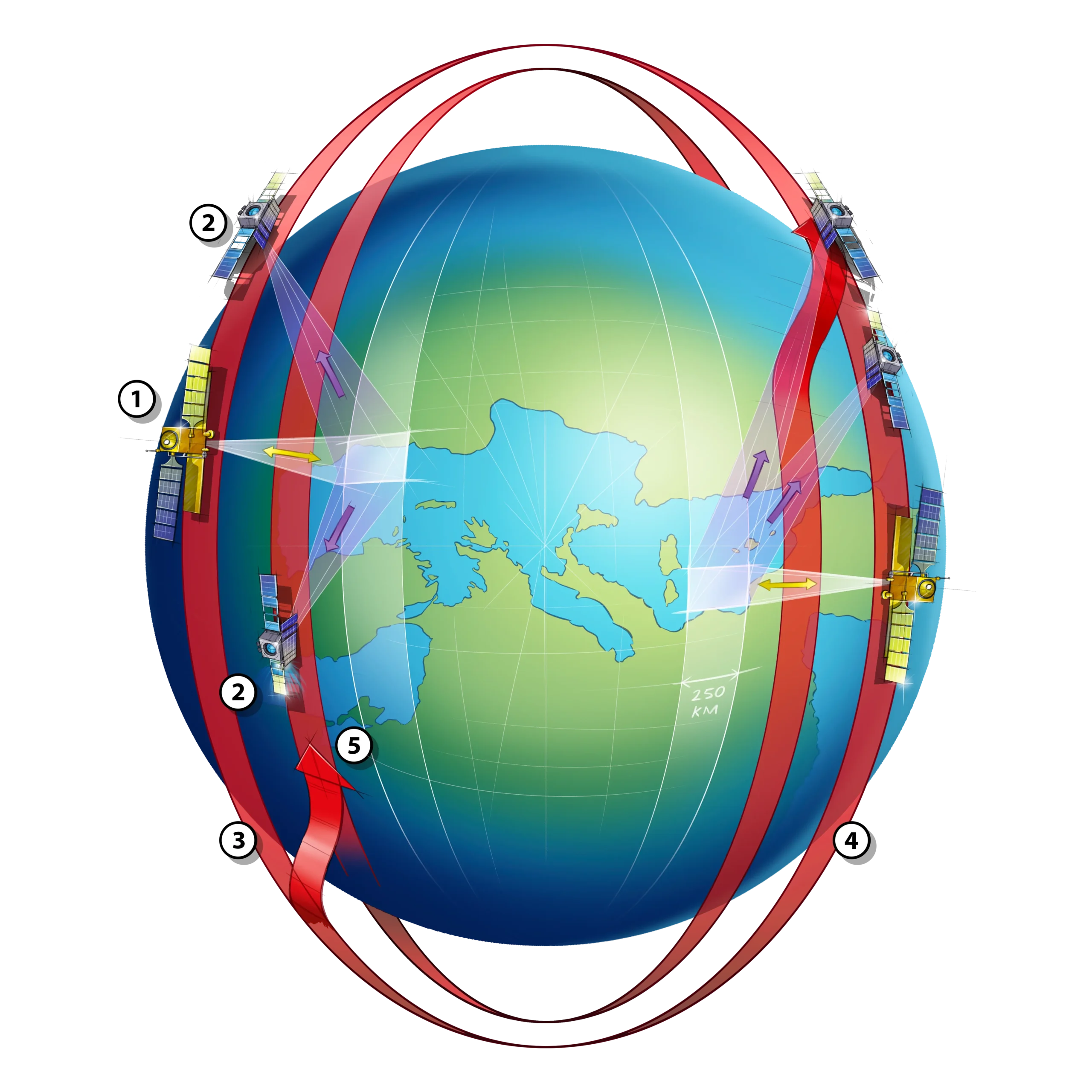
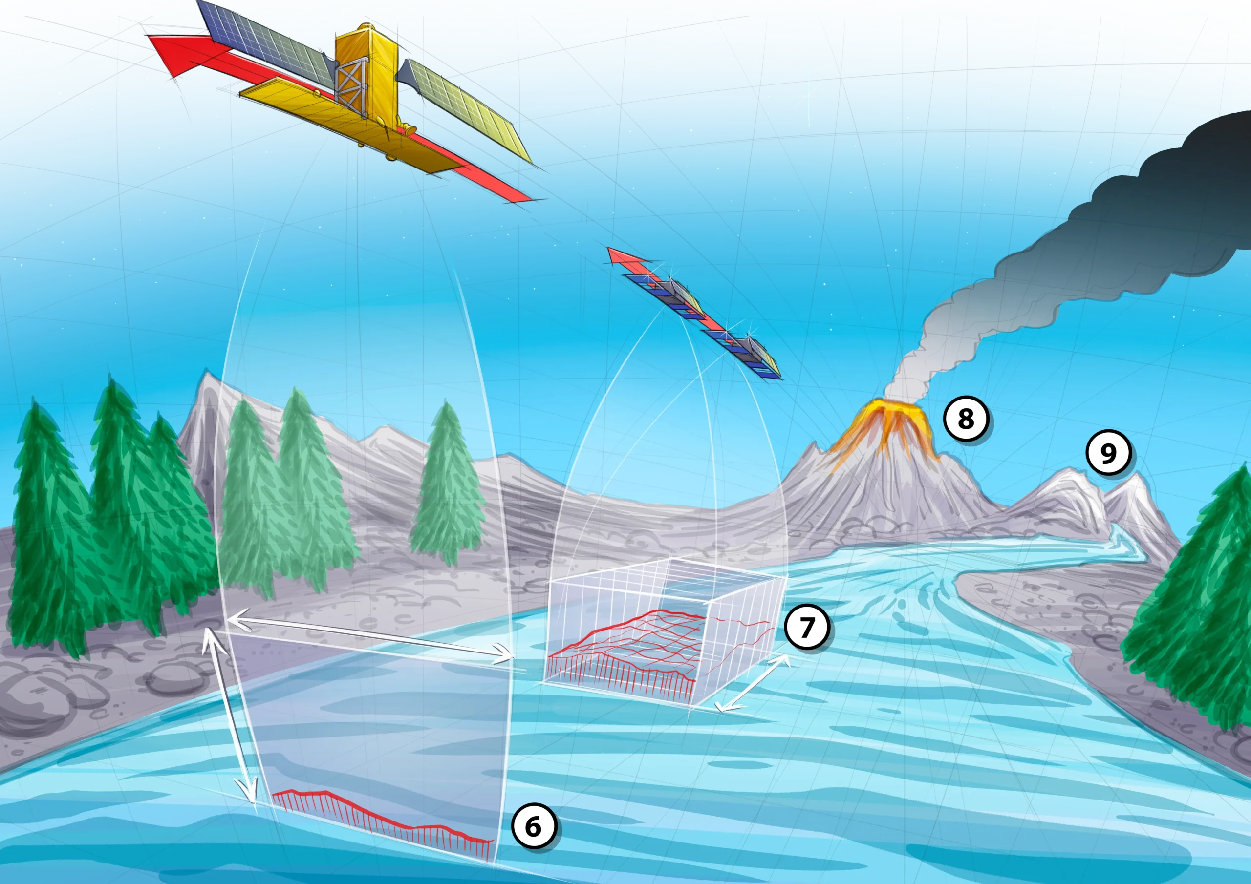
Sentinel 1 emits radar pulses, whilst the Harmony satellites 2 receive and process the reflections. They fly 366 kilometres in front of and behind the Sentinel 3, or they fly as a duo close together 4 at a distance from Sentinel. Harmony A and B can drop back down 5 into a lower orbit to catch up with the Sentinel satellite, as well as return again to the same orbit.

Detection works by way of radar interferometry – a proven InSAR (Interferometric Synthetic Aperture Radar) technique for studying slow movements on the ground. The resolution of radar lies in the order of metres (or dozens of metres), but interferometry clearly shows shifts of a few millimetres a year. InSAR is very sensitive, especially in the line of sight, more or less perpendicular to the direction of movement, in other words in the east-west and vertical directions 6. Thanks to Harmony A and B, the north-south direction has now also been added. Shifts on the Earth’s surface are therefore recorded in three directions in one go 7. For example: surface measurements of intumescent volcanoes 8 or melting glaciers 9. By combining measurements of height change and flow speed (up to metres per day), the speed of ice loss can be calculated.
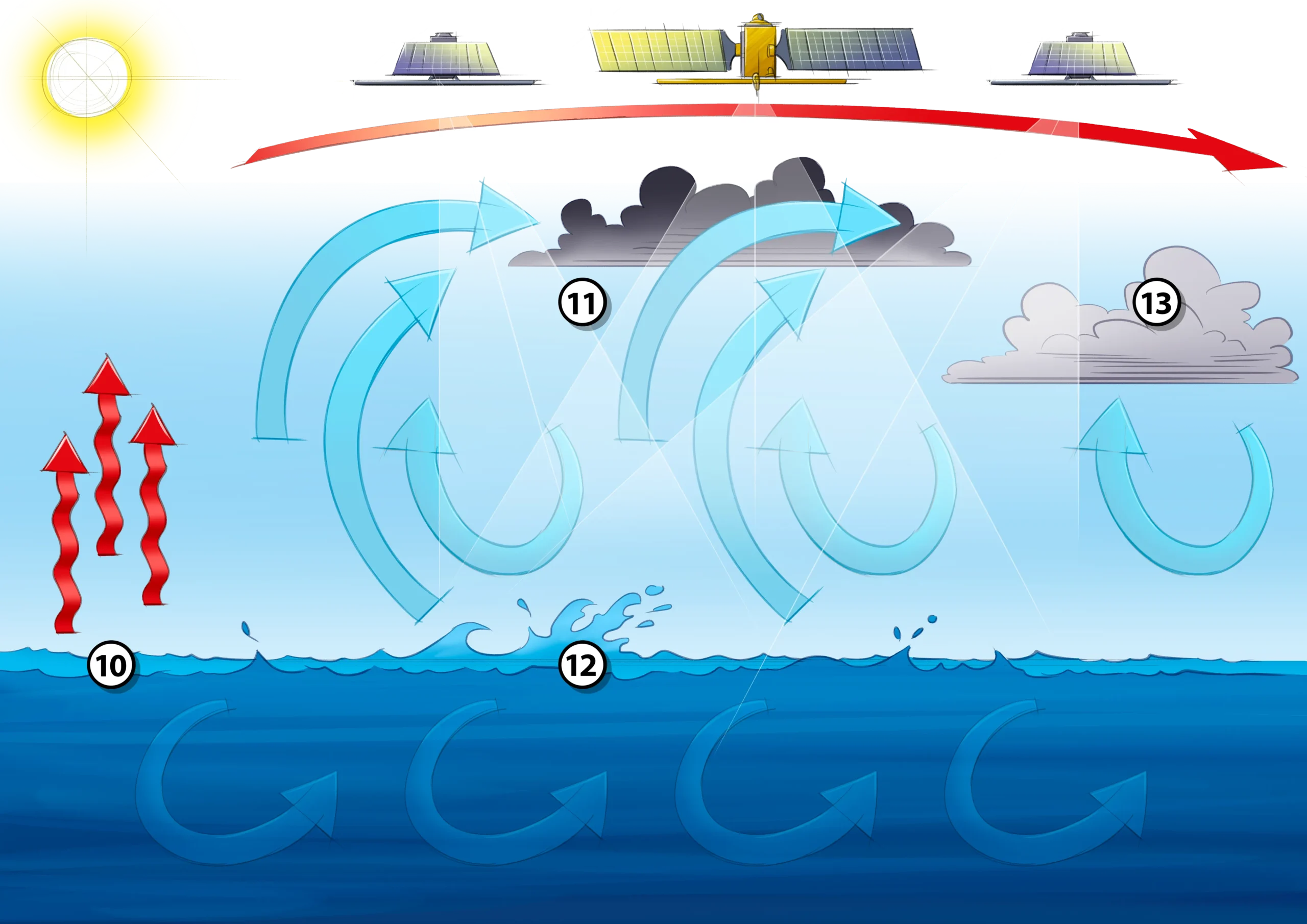
Energy exchange between the ocean and atmosphere is Harmony’s main focus. The satellite uses infra-red measurement 10 to determine the temperature of the surface water. Currents are measured with Doppler 11, as is the case with traffic controls. The dispersion is a measure for the roughness of the sea 12 and thereby for the prevailing wind. Harmony can measure both the height and the speed of clouds 13. All that data can be used to test weather models. “Our aim is to translate the exchange between air and water that occurs between 100 metres and a kilometre into parameters for climate models”, is how López-Dekker summarises the Harmony mission.