Centrefold
Four billion
ship positions
Text Jos Wassink
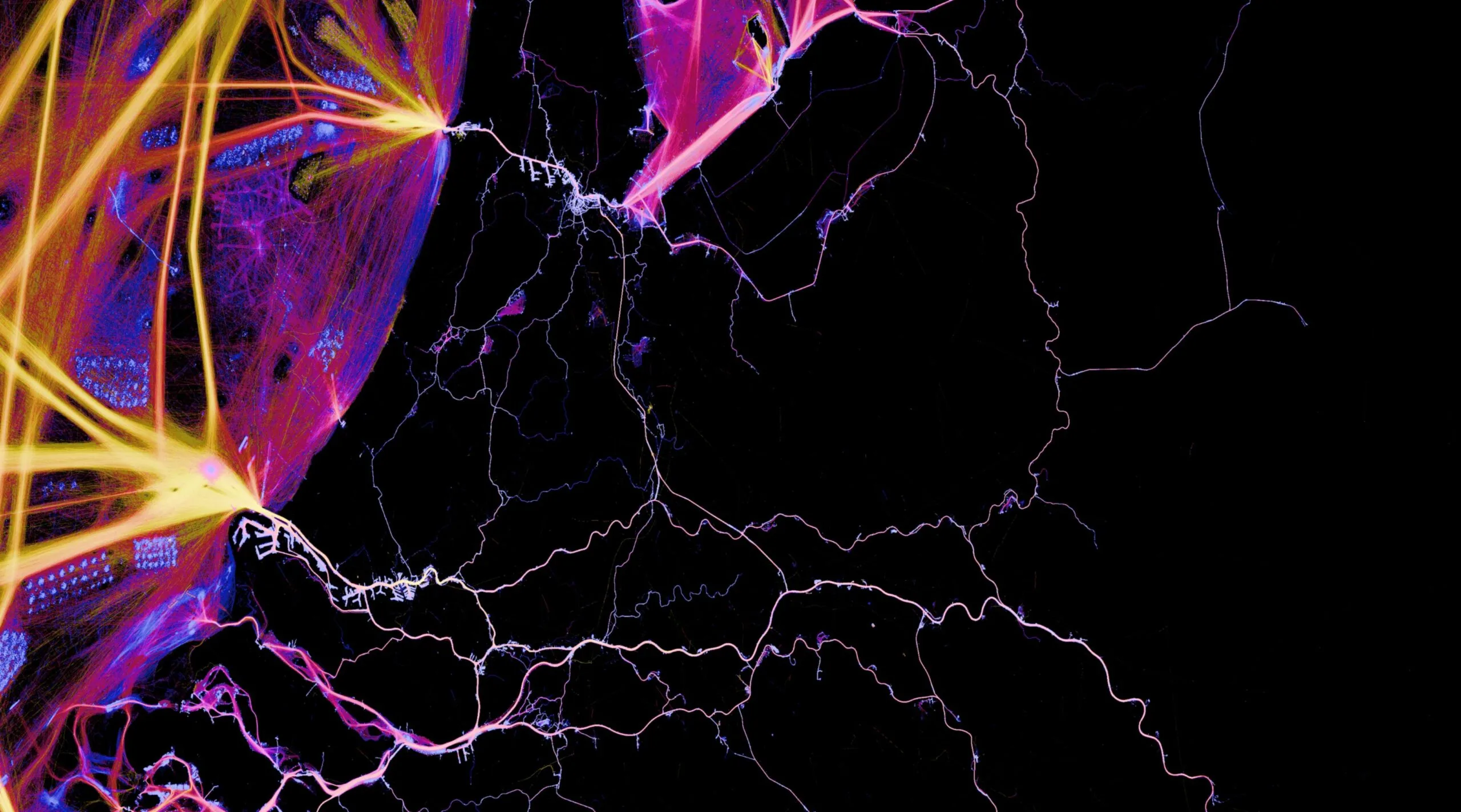
The image shows the ship movements around Rotterdam. On the main shipping routes, the ships are accelerating fast (yellow stripes) and setting course for their destination. South of the shipping routes, vessels are anchored. Just outside the Nieuwe Waterweg, to the north of the shipping route, pilot boats lie in wait.
Most ships are equipped with an Automatic Identification System that emits a signal at least every six minutes with information about vessel type, size, position, course and speed. The data show how busy it is on shipping routes, waiting times
at ports and locks, speed of travel and diversions taken by ships. But access is limited for privacy reasons. Last year, Rijkswaterstaat allowed a consortium of TU Delft, Deltares and Marin access to the anonymised shipping movements over a four-month period: some four billion ship positions. With the Planetary Computer (used by climate researchers), PhD candidate Solange van der Werff charted these positions with extreme precision. Billions of little dots grew into a unique map of maritime activity.
© Solange van der Werff
Four billion
ship positions
Tekxt Jos Wassink
The image shows the ship movements around Rotterdam. On the main shipping routes, the ships are accelerating fast (yellow stripes) and setting course for their destination. South of the shipping routes, vessels are anchored. Just outside the Nieuwe Waterweg, to the north of the shipping route, pilot boats lie in wait.
Most ships are equipped with an Automatic Identification System that emits a signal at least every six minutes with information about vessel type, size, position, course and speed. The data show how busy it is on shipping routes, waiting times
at ports and locks, speed of travel and diversions taken by ships. But access is limited for privacy reasons. Last year, Rijkswaterstaat allowed a consortium of TU Delft, Deltares and Marin access to the anonymised shipping movements over a four-month period: some four billion ship positions. With the Planetary Computer (used by climate researchers), PhD candidate Solange van der Werff charted these positions with extreme precision. Billions of little dots grew into a unique map of maritime activity.
© Solange van der Werff